Col du Loson, from the Valnontey car park

Edited by:
Massimo Martini
Updated at: 16/11/2026
Access
Road directions
At the Aosta Ovest motorway junction, enter the roundabout and take the second exit, following the signs for / Cogne / Aymavilles. Continue along the for 20.0 km (20.0 km) until you reach the roundabout at the entrance to Cogne, where you should take the first exit onto Avenue G.F. Cavagnet (350 m, 20.35 km). Continue along Via Bourgeois (120 m, 20.5 km), then turn right onto Rue Grand Paradis. Follow Rue Grand Paradis for 2.4 km (22.9 km), continue through the hamlet of Valnontey for 210 m (23.1 km) and turn right to reach the car park.
Car park
At the end of the road is the Valnontey car park 🅿️, the access point to the Gran Paradiso National Park. Please check on site for access conditions and any seasonal restrictions imposed by the park authority.
Access by public transport
The Valnontey car park can be reached via the Cogne circular bus route operated by SVAP. The relevant stop is Cogne Valnontey. The winter service runs every weekday and on public holidays, except 25 December and during the summer; services to the Valnontey stop depart from Cogne Revettaz at 09:00, 10.05, 11.10, 12.40 and 15.00, arriving at Valnontey at 09.25, 10.30, 11.35, 13.05 and 15.25 respectively. For up-to-date timetables, please consult the SVAP – Cogne Urban Line timetable.
Distance and journey time
🕒 Journey time: 35 minutes
📏 Distance: 23.5 km
GPS navigation
Important information
The directions provided were verified on the date the route was mapped. Before setting off, we recommend checking for any changes to the route or road conditions. For up-to-date information, please consult Google Maps or Apple Maps.
Introduction
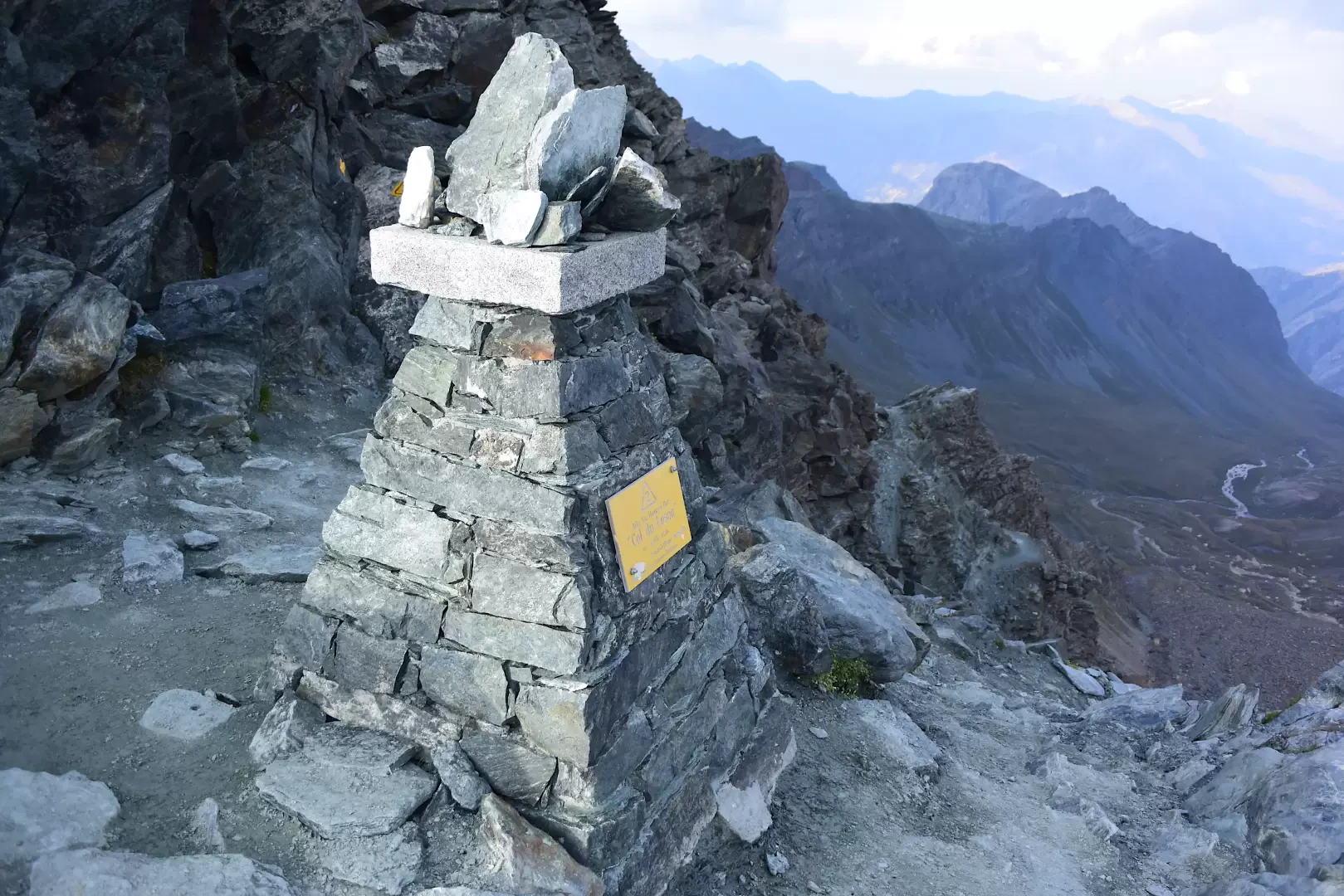
Col Loson (3,299 m) is an iconic landmark for hikers in the Aosta Valley: it is the highest point on the Alta Via 2 trail in the Aosta Valley, the so-called ‘nature trail’ that crosses the southern slopes of the region, and is also the Cima Coppi of the Tor des Géants, the famous endurance trail race.
The route from Valnontey runs entirely within the Gran Paradiso National Park, passing through areas teeming with wildlife where chamois, ibex and marmots are frequently spotted. The ascent follows the entire Loson Valley along the Alta Via 2 route, with a stop-off at the Vittorio Sella Mountain Hut, before tackling the steepest and most exposed slopes leading to the pass.
From the summit, the view stretches from the Gran Paradiso glaciers to the main peaks of the Valsavarenche and the Cogne Valley, offering one of the most expansive and evocative panoramas of the entire massif.
Description
0h00' 0.00km From the Valnontey square, follow the tarmac road for a short distance until you reach the village of the same name, where there is a drinking fountain 💧.
0h02' 0.13km Turn right and cross the Valnontey stream, keeping to the left bank. Follow the road uphill to the Lou Tsantelet Hotel and the square with the shelter housing the signposts for the main routes of the Alta Via . Take path , which crosses the pasture and leads to the Paradisia Alpine Garden. Follow the south-eastern edge of the garden along an easy mule track, enter the larch forest and gain altitude via a series of gentle hairpin bends, with panoramic views over the Valnontey, until you reach a junction at an altitude of 1,950m.
0h02' 2.03km (304 m ascent) (0 m descent) Ignore the continuation along the old royal road (closed) and carry on straight ahead to the stone bridge over the Torrent de Grand Loson, where it forms a spectacular little waterfall. Cross the bridge, head up the right-hand side (as you face the stream) and emerge from the woodland. Continue across the pastures to the ruins of Toules (2,001 m), where there is a small fountain 💧. Follow the twists and turns of the path as it skirts the houses of Pascieux (2,224m). Climb through a sparse larch forest and open pastures, with views of the ruins of Petit Loson and the Grand Croux and Tribolazione glaciers. The path bends to the right, passes a short stone staircase and descends towards the watershed of the Torrent de Grand Loson (2,260 m). Cross the wooden bridge, then climb up the orographic left-hand slope with long traverses until you rejoin the old royal hunting road. Continue halfway up the steep grassy slopes beneath Tête Tsaplane, then tackle steeper hairpin bends. Ignore the junction for the Grand Loson mountain pastures (2,506 m) and continue on a moderate climb to the park ranger’s hut, where the path forks, allowing you, via a short descent across the meadows, to reach the Vittorio Sella Mountain Hut (2,584 m) 💧.
2h30' 5.79km (925 m ascent) (0 m descent) Return to the park ranger’s hut and rejoin the Alta Via 2 trail towards Col Loson. The route crosses open pastures and climbs up the valley, keeping to the left-hand side, until it reaches a wide sandy plateau near the junction for Col de la Rousse (2,850 m).
3h15' 7.62km Ignore the path on the right and continue along the main route. The gradient increases gradually, making the ascent more challenging. The path climbs in numerous hairpin bends towards the rocky outcrops of Becca di Vermianaz, until it reaches a panoramic pass from which Col Loson is clearly visible. Continue along a narrow track that crosses exposed ledges, equipped with metal bars and fixed ropes in the most tricky sections. Pass a short traverse beneath the rocks and tackle the final scree-filled gully, which is steep and unstable but presents no technical difficulties, apart from the physical effort required. Finally, you reach the iconic Col du Loson (3,299m) 4h30' 10.39km .
The return journey follows the same route as the outward leg, retracing the path back to the starting point at the Valnontey car park 3h15' 10.39km (0 m elevation gain) (1,606 m elevation loss).
Places of interest
Valnontey
Toules
Pascieux
Grand Loson
Vittorio Sella Mountain Hut
Comments (0)
Sign in to leave a comment